what I'm currently working on:
I'm building police tech. Current systems are insanely slow due to their old and cluttered tech. Furthermore, public and media scrutiny is causing the industry to plummet in terms of recruitment. As a result, officers struggle to keep up with crime while being forced to do 16-hour overtime shifts.
the inspiration
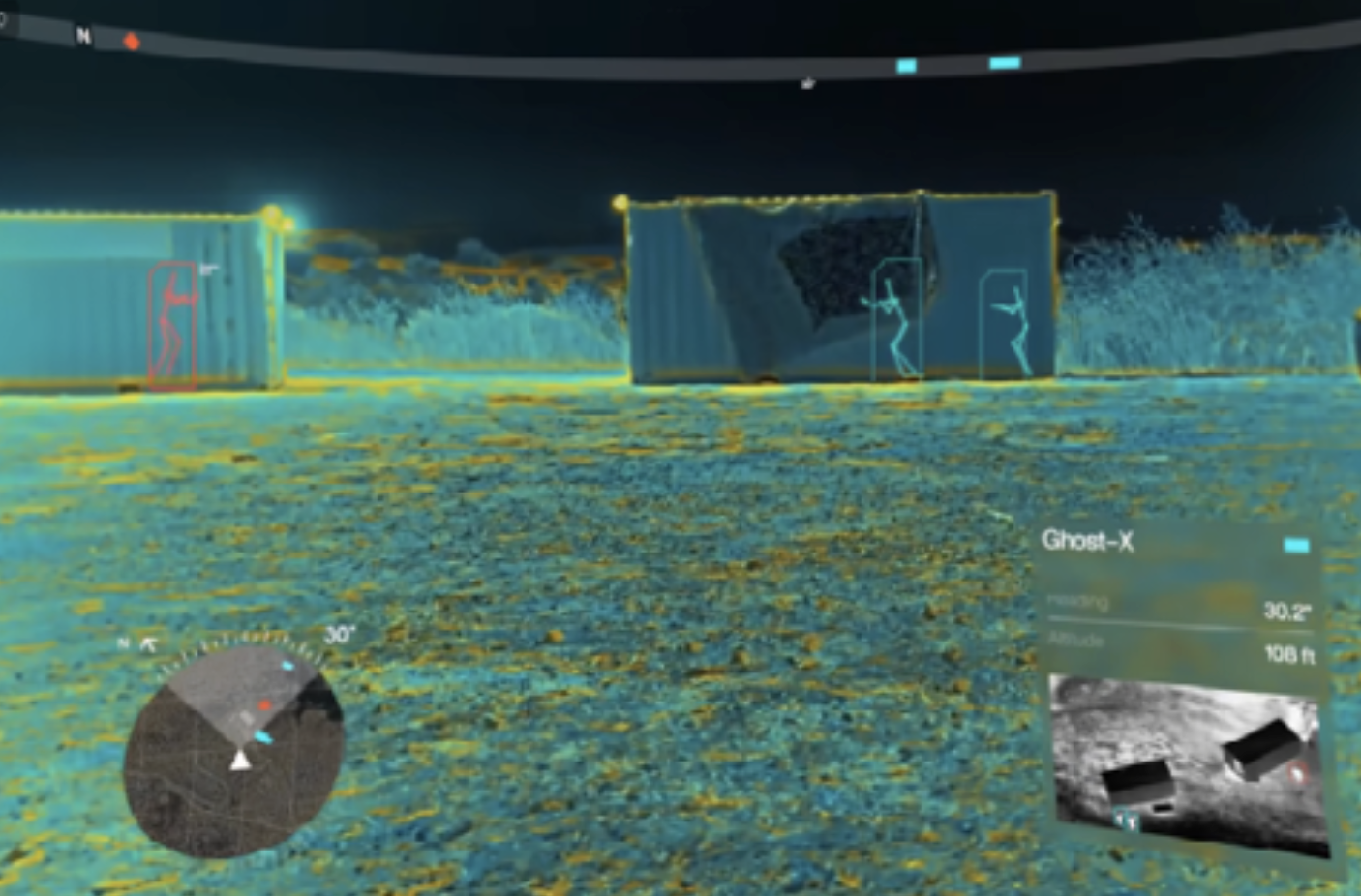
Wanted to recreate something like Anduril's EagleEye — a system that lets you see suspect cars through buildings and natural terrain in real time during police pursuits. That kind of situational awareness shouldn't be limited to military-grade budgets.
the fake car chase
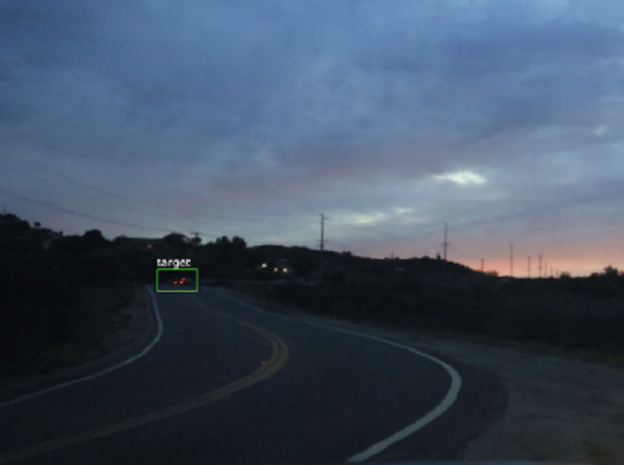
car: visible
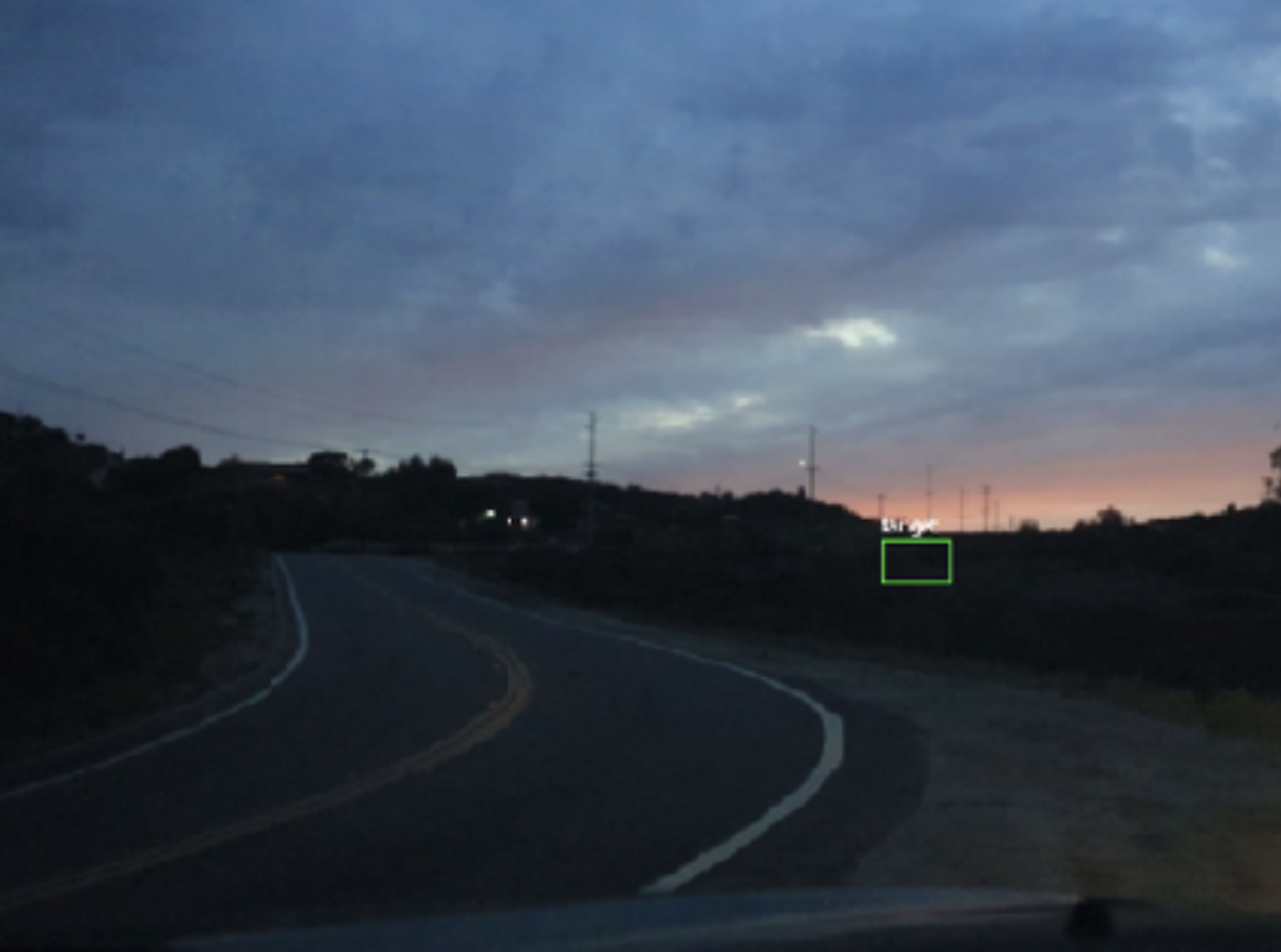
car: gone — but AR still tracks it
Ran a mock car chase with friends to test the concept. Even when the suspect car disappears from view, the AR overlay pinpoints its location using live drone data. A drone flying above feeds position data down so the pursuing car never loses track.
$150 bucket of broken drones
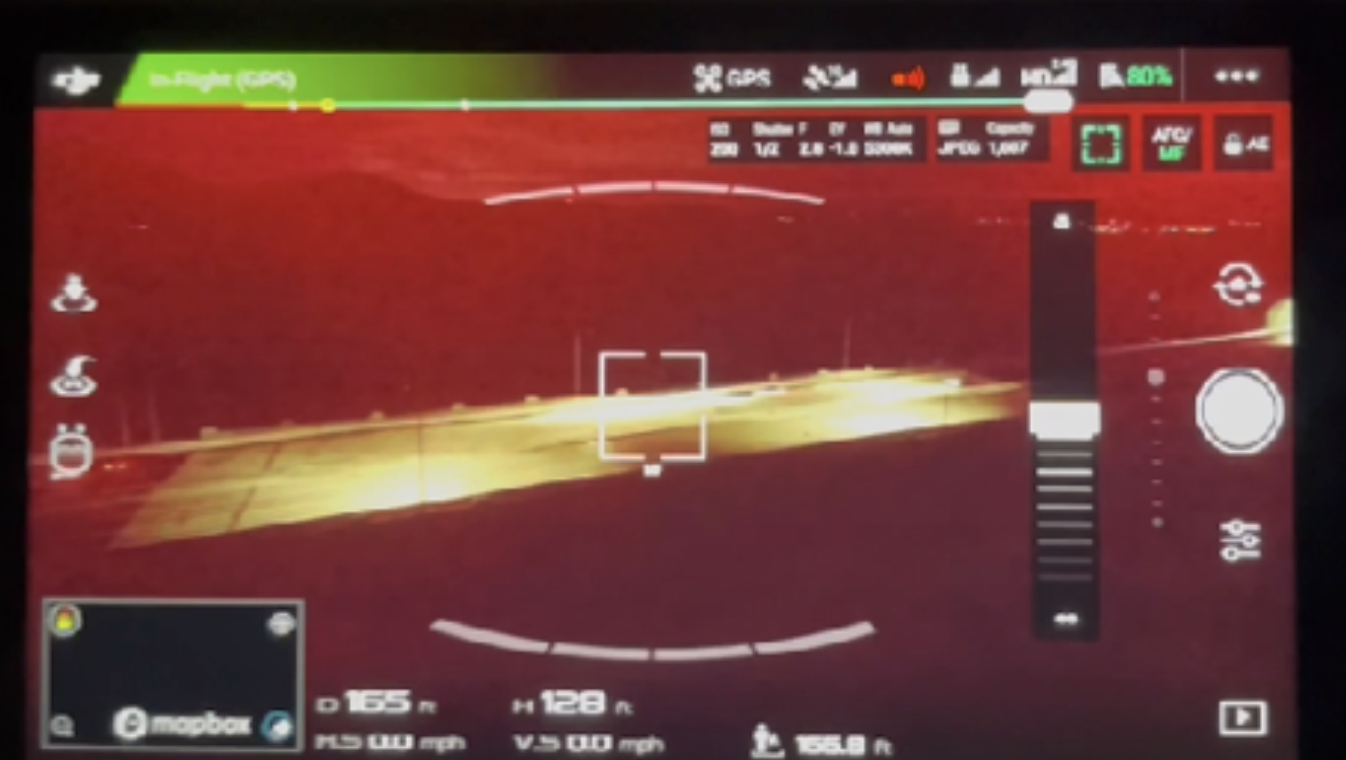
One of my favorite things is flipping Facebook Marketplace gadgets. I bought a $150 bucket of ~50 broken drones and fixed up a Phantom 4 Pro Plus. Took one of my first recordings of a highway with it and tested the AR overlay live.
how it actually works
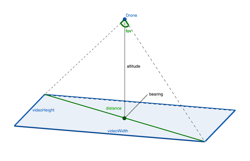
The drone imitates the live aerial footage you'd normally get from a helicopter during a pursuit. It streams GPS data along with yaw, pitch, and roll — from there, basic trigonometry calculates the suspect's position on the video frame and sends the overlay to the officer's display in the cop car.
the GIS system
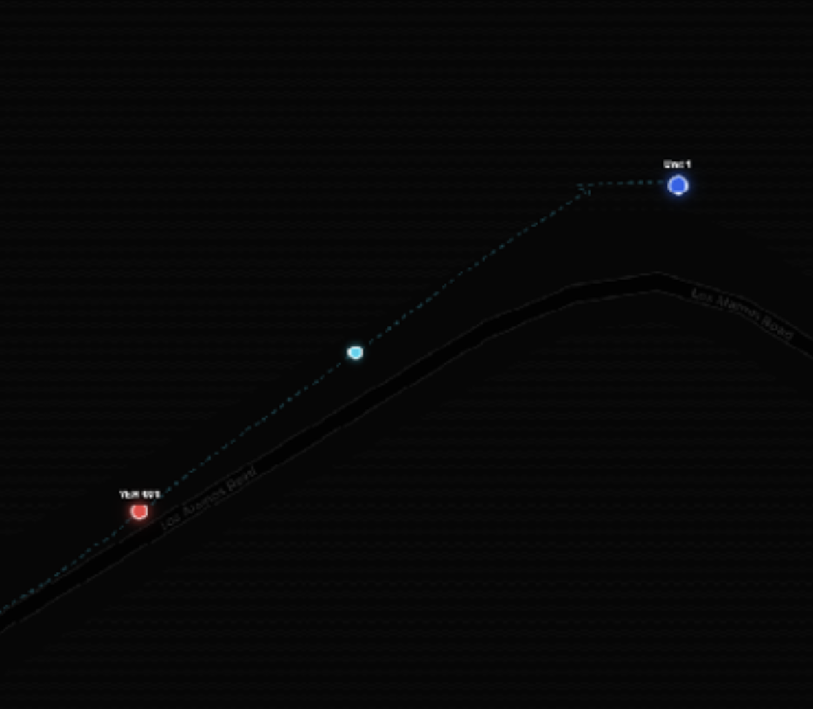
Built a basic GIS system to tie it all together. Red is the suspect vehicle, teal is the drone or helicopter, and blue is the pursuing cop car. Everything updates in real time so dispatch and officers share the same picture.